Data & Information
Data, Mapping & Imaged Documents
The Division of Water Resources’ (DWR) database of streamflows, diversion records, lake storage levels, water rights, water right calls, well applications and more is known as HydroBase. This information is maintained by DWR to support water administration as well as to inform the public.
DWR provides a wide range of research tools that are available online free of charge. These enable users to search, retrieve and analyze DWR's water database and associated images and documents. Research tools may be divided into two classes: Data Search Tools, which allow the users to search using keywords and filters; and Geographic Information System (GIS) / Mapping Tools, which use a GIS interface to search and display data and contain more spatial information and layers.
Colorado's Decision Support Systems (CDSS) Data & Tools and the Colorado Information MarketPlace (CIM) serve as clearinghouses for DWR datasets including Administrative Calls, Climate Stations, Dam Safety, Diversion Records, Groundwater (Water Levels/Logs), Stations (Streamflows/Ditch Diversions), Water Rights, and Well Permits. Additional online tools include Aquifer Determination, Call Analysis, Location Conversion Tools, and REST Web Services.
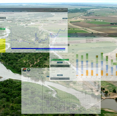
Colorado's Decision Support Systems (CDSS)
CDSS is a data-centered, water management system funded through Colorado Water Conservation Board (CWCB) with technical support from both CWCB and Division of Water Resources (DWR) staff. The goal of this system is to assist in making informed decisions regarding historical and future use of water. Both DWR and CWCB have a hand in developing, managing and enhancing CDSS tools and models for the major river basins in Colorado. CDSS data is pulled from DWR's HydroBase database.
Important Links
Colorado's Decision Support Systems
Modeling software to help manage our state's most precious resource
Data & Information Rules & Regulations
The Division of Water Resources’ Online Data Submittal application allows users to submit data to DWR. Data that can be submitted include diversion records, meter readings, reporting (such as augmentation accounting), and well water levels.
First, create your user account, then begin using our data submittal tools.
Diversion Records
Diversion records document the source and volume of water diverted or released; and how and where that water was put to beneficial use. Water users required to submit user provided information will be setup with an account to be able to submit daily, monthly and/or annual diversions.
- Online Tool: Diversion Records
- User Guide: How To Bulk Upload Diversion Records
- Videos: (Coming Soon)
Meter Readings
Pursuant to well measurement rules and rules for the management of designated ground water in the South Platte River, Republican River, Arkansas River, Rio Grande and designated ground water basins (Rules), water users will be setup with an account to be able to submit monthly and/or annual compliance meter readings.
- Online Tool: Meter Readings
- User Guide: How to Use Meter Reading Submittal
- Videos: How to Enter Meter Readings
Reporting Submittal
Augmentation Accounting spreadsheets and data files, and other types of reporting, may be required by your DWR Division Office. To submit these files using our online system, inquire with your local Division Staff, as they will assist with providing access to upload the appropriate files.
- Online Tool: Reporting Submittal
- User Guide: How to submit reporting to DWR
- Videos: How to Upload Reporting required by DWR
Water Levels
House Bill 15-1166 directed the State Engineer, in consultation with the Colorado Water Conservation Board (CWCB), to develop and publish protocols for groundwater level data measurement, collection, and entry. To learn more about the cooperator program or join, review the Cooperator Groundwater Level Measurement Program document below. This document provides a link to the protocols, as well as links to documents outlining the information necessary to set up a third-party account profile and documentation required for each well included in the monitoring program. Users wanting to share water level data can contact the Hydrogeology team in the Denver office.
- Cooperator Groundwater Level Measurement Program
- Groundwater Levels Monitoring Protocols
- Online Tool: Water Levels
- User Guide/Videos: (Coming Soon)